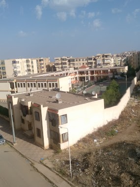
School nearby School Les Frères Attar
Coronavirus disease (COVID-19) Situation
confirmed cases
272010
deaths
6881
Algeria
School nearby School Les Frères Attar
School Les Frères Attar
Tlemcen, Algeria
contacts phone
:
+213
Latitude:
34.9221074
, Longitude:
-1.2996161
larger map & directions
read more
nearest School
336 m
Primary School Belarbi Mansour
Chetouane
School
read more
383 m
Ecole Primaire Ibn Sina
Chetouane
School
read more
477 m
روضة أطفال براعم المستقبل
Chetouane
School
read more
517 m
Ecole Primaire Haï Zitoune
13000, vers chetouane / vers la wilaya de sidi bel abbes
School
read more
695 m
Cem Habibes Abderahman - Chetouane
Chetouane
School
read more
791 m
Mammache Nadir
Tlemcen
School
read more
795 m
Cem Malik-Ibno Anesse
Chetouane
School
read more
963 m
Cem Chetouane
Tlemcen
School
read more
1.03 km
ثانوية شتوان الجديدة
Chetouane
School
read more
1.044 km
Frère Benmansour
Tlemcen
School
read more
1.2 km
CEM CHENINI AHMED AIN DEFLA
Mosquée de la nouvelle Ain Defla, vers chetouane / vers la wilaya de sidi bel abbes, Tlemcen
School
read more
1.382 km
Primary Ain Defla
Tlemcen
School
read more
1.927 km
Ecole Primaire zerga Redwan
Tlemcen
School
read more
2.061 km
CEM Zerga Redwan
Tlemcen
School
read more
2.064 km
Cem Bekhti Abd Rezak
Tlemcen
School
read more
2.217 km
High School Of Oudjlida
Tlemcen
School
read more
2.234 km
Opag Mahmoud School
Abou Tachefine, Tlemcen
School
read more
2.248 km
Auto Ecole Younes
Tlemcen
School
read more
2.262 km
Ecole Primaire Abou Tachfine
Tlemcen
School
read more
2.371 km
Ismarten School
Tlemcen
School
read more
2.448 km
Moyen Mohammed Bin Ahmed Al-Habbak
L'entrée de Tlemcen N22, Tlemcen
School
read more
2.566 km
Manger Eden
269, oujlida, Tlemcen
School
read more
2.625 km
مدرسة العباسي التلمساني
Abou Tachefine
School
read more
2.666 km
ثانوية الشهيد بوبلنزة محمد
Tlemcen
School
read more
2.91 km
CEM Tahar Hmaidia
Tlemcen
School
read more
📑
all categories
Accounting
Administrative area level 1
Airport
Amusement park
Aquarium
Art gallery
Atm
Bakery
Bank
Bar
Beauty salon
Bicycle store
Book store
Bus station
Cafe
Car dealer
Car rental
Car repair
Car wash
Cemetery
Church
City hall
Clothing store
Colloquial area
Convenience store
Courthouse
Dentist
Department store
Doctor
Electrician
Electronics store
Embassy
Establishment
Finance
Fire station
Florist
Food
Funeral home
Furniture store
Gas station
General contractor
Grocery or supermarket
Gym
Hair care
Hardware store
Health
Home goods store
Hospital
Insurance agency
Intersection
Jewelry store
Laundry
Lawyer
Library
Light rail station
Liquor store
Local government office
Locality
Lodging
Meal takeaway
Mosque
Movie rental
Movie theater
Moving company
Museum
Natural feature
Neighborhood
Night club
Painter
Park
Parking
Pet store
Pharmacy
Physiotherapist
Place of worship
Plumber
Point of interest
Police
Post office
Premise
Real estate agency
Restaurant
Roofing contractor
Route
School
Shoe store
Shopping mall
Spa
Stadium
Storage
Store
Subway station
Supermarket
Taxi stand
Train station
Transit station
Travel agency
University
Veterinary care
Zoo
administrative area level 3
sublocality level 1
↑