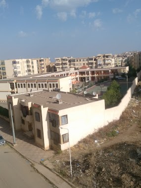
School nearby Mahi Boumedienne
Algeria
School nearby Mahi Boumedienne
Mahi Boumedienne
Tlemcen, Algerien
contacts phone
:
+213
Latitude:
34.8767556
, Longitude:
-1.3586891
larger map & directions
read more
nearest School
314 m
Faculty Of Law
Mansourah
School
read more
345 m
Epse-csg, Tlemcen
Route EPSECG, Tlemcen
School
read more
345 m
Ecole Superieure De Management
ESM, Tlemcen
School
read more
2.278 km
Primary School Benaissa El Aïd
Tlemcen
School
read more
2.29 km
crèche hayat et les anges
Tlemcen
School
read more
2.775 km
Ecole Paramedical
Tlemcen
School
read more
2.793 km
INSTITUT NATIONAL DE FORMATION SUPERIEURE DE SAGES FEMMES TLEMCEN
Rue 2, Terni Ben Hadiel
School
read more
2.934 km
مدرسة المغيلي عبد الكريم
1300, L'entrée de Tlemcen N22, Tlemcen
School
read more
2.953 km
Epst
Tlemcen
School
read more
3.103 km
Ecole Regionale De La Poste Tlemcen
Tlemcen
School
read more
3.299 km
Etm
Tlemcen
School
read more
3.365 km
Primary School Zouad
Tlemcen
School
read more
3.389 km
Cem Temimi متوسطة التميمي
15 نهج درار عبد الرحمنBoulevard Derrar Abderrahman, Tlemcen
School
read more
3.463 km
Ettalassi
Tlemcen
School
read more
3.474 km
Crèche La Ribambelle
303, 234 les Dahlias, Tlemcen
School
read more
3.543 km
Primary School Hamri Ahmed
Tlemcen
School
read more
3.925 km
Driving School Kersani Bachit
sidi chaker, Tlemcen
School
read more
3.942 km
School Dr Benzerdjeb
Tlemcen
School
read more
4.056 km
ثانوية بصغير لخضرLycée Bessghir Lakhdar
Tlemcen
School
read more
4.241 km
Center Linguistic Berrichi
Unnamed Road, Tlemcen
School
read more
4.546 km
Ecole Primaire El Aissouf
Tlemcen
School
read more
5.004 km
Moyen Mohammed Bin Ahmed Al-Habbak
L'entrée de Tlemcen N22, Tlemcen
School
read more
5.18 km
Opag Mahmoud School
Abou Tachefine, Tlemcen
School
read more
5.623 km
Cem Bekhti Abd Rezak
Tlemcen
School
read more
6.7 km
Cem Habibes Abderahman - Chetouane
Chetouane
School
read more
📑
all categories
Accounting
Administrative area level 1
Airport
Amusement park
Aquarium
Art gallery
Atm
Bakery
Bank
Bar
Beauty salon
Bicycle store
Book store
Bus station
Cafe
Car dealer
Car rental
Car repair
Car wash
Cemetery
Church
City hall
Clothing store
Colloquial area
Convenience store
Courthouse
Dentist
Department store
Doctor
Electrician
Electronics store
Embassy
Establishment
Finance
Fire station
Florist
Food
Funeral home
Furniture store
Gas station
General contractor
Grocery or supermarket
Gym
Hair care
Hardware store
Health
Home goods store
Hospital
Insurance agency
Intersection
Jewelry store
Laundry
Lawyer
Library
Light rail station
Liquor store
Local government office
Locality
Lodging
Meal takeaway
Mosque
Movie rental
Movie theater
Moving company
Museum
Natural feature
Neighborhood
Night club
Painter
Park
Parking
Pet store
Pharmacy
Physiotherapist
Place of worship
Plumber
Point of interest
Police
Post office
Premise
Real estate agency
Restaurant
Roofing contractor
Route
School
Shoe store
Shopping mall
Spa
Stadium
Storage
Store
Subway station
Supermarket
Taxi stand
Train station
Transit station
Travel agency
University
Veterinary care
Zoo
administrative area level 3
sublocality level 1
↑